Hours
Daylight visits recommended; confirm seasonal access
Pai · Mae Hong Son · Thailand
A community-built merit bridge leading toward a forest temple
The woven bamboo walkway near Ban Pam Bok winds across fields and wooded foothills. It is a gentle rural alternative to Pai Canyon and a different scene from Yun Lai’s hilltop panorama.
Hours:Daylight visits recommended; confirm seasonal access
Location:Ban Pam Bok, Thung Yao, Pai District, Mae Hong Son 58130, Thailand (89FV+273)
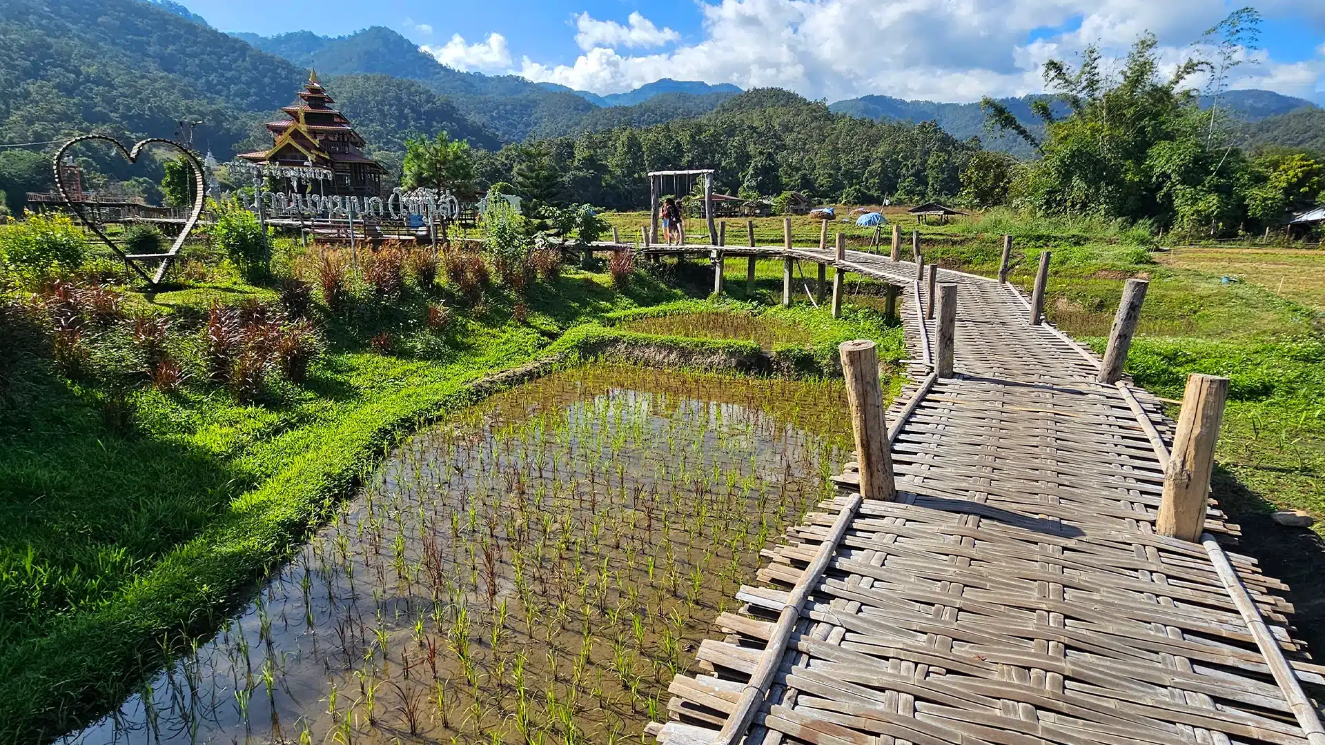
The bridge was built through cooperation between local villagers and Buddhist clergy to connect the community and a temple route. Local community visitor arrangements and maintenance may change; respect both farmland and religious spaces.
Boon Ko Ku So, also spelled Kho Ku So, is a merit-making bridge associated with Ban Pam Bok. The route over rice fields helps connect villagers and monks. Tourism grew around a path that also has a community and religious purpose.
The woven bamboo walkway near Ban Pam Bok winds across fields and wooded foothills. It is a gentle rural alternative to Pai Canyon and a different scene from Yun Lai’s hilltop panorama. Study the bamboo weaving at eye level, see how the bridge bends through the fields, and observe mountain backdrops without trampling crops.
Bamboo can be uneven or slippery after rain; avoid crowding narrow spans and respect farm boundaries.
The walkway uses a woven split-bamboo deck on simple posts, forming long curves across paddy plots. Seasonal green shoots, golden rice or fallow earth change the visual experience dramatically.
Daylight visits recommended; confirm seasonal access
Small community maintenance contribution may apply
Approach from Pai toward Ban Pam Bok in Thung Yao. The final small roads can be narrow; navigate to Boon Ko Ku So Bridge using its own map search and 89FV+273 reference.
Boon Ko Ku So, also spelled Kho Ku So, is a merit-making bridge associated with Ban Pam Bok. The route over rice fields helps connect villagers and monks. Tourism grew around a path that also has a community and religious purpose.
The walkway uses a woven split-bamboo deck on simple posts, forming long curves across paddy plots. Seasonal green shoots, golden rice or fallow earth change the visual experience dramatically.
Study the bamboo weaving at eye level, see how the bridge bends through the fields, and observe mountain backdrops without trampling crops.
Approach from Pai toward Ban Pam Bok in Thung Yao. The final small roads can be narrow; navigate to Boon Ko Ku So Bridge using its own map search and 89FV+273 reference.
Reach the site in daylight and check current walkway condition.
Walk slowly along the bamboo deck, using passing points for photographs.
Return along the marked route and consider a separate stop at Pam Bok area.
Bamboo can be uneven or slippery after rain; avoid crowding narrow spans and respect farm boundaries.
From designated widened platforms, compose the curving bamboo path as a leading line toward the hills. Morning side-light brings out the woven texture. Stay off planted fields.
Pai town has broad accommodation choices; this is best treated as a day trip.
No. Boon Ko Ku So is in the Pai / Ban Pam Bok area and has its own map pin.
No. Rice appearance changes with planting, growth and harvest seasons.
For up-to-date visitor feedback and review counts, consult the specific Google Maps place listing. This guide does not reproduce unverified scores.
Google Maps ↗Ban Pam Bok, Thung Yao, Pai District, Mae Hong Son 58130, Thailand (89FV+273)
Use this attraction’s own destination pin; confirm the final approach and transport arrangements before departure.
Open this place in Google Maps ↗Photo source and fact checking: Wikimedia Commons · Tourism Authority of Thailand